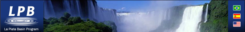
 La Plata Basin Program
In recent years there has been a major effort toward a closer
integration between countries in South America. Of particular
relevance, Argentina, Brazil and Uruguay, together with Paraguay,
currently operate as a common economic market in southern
South America (MERCOSUR). Regional governments are using the
framework of the MERCOSUR to develop common socioeconomic
policies, and in fact the scientific community is also starting
to use MERCOSUR's structure to establish regional collaborative
research activities. For these reasons, this time is especially
auspicious for establishing collaborative projects in southern
South America.
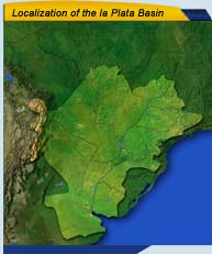
The La Plata basin in southeastern South America has always
been a subject of interest for all of these countries because
of its importance in the regional economies. But it is also
important from the scientific standpoint due to the uniqueness
of many of its climatological features. La Plata basin is
located in an area where significant tropical-extratropical
interactions take place; it holds the largest wetland in the
world, known as "Pantanal", that naturally regulates
floods, is a local source of moisture for precipitation processes,
and has a wide variety of unique flora and fauna species.
The WMO/WCRP CLIVAR panel on the Variability of American Monsoon
Systems (VAMOS) has found general consensus on the region's
readiness to embark on and support collaborative research
on the La Plata Basin's climate/hydrology. This readiness
is primarily due to an enhanced awareness of the impact that
climate variations can have on water resource management,
energy production, agriculture and health. Improved prediction
can potentially result in large economic and social benefits
to the region. |

)
)
)
)
)
)
)